St Teath circular walk

St Teath

A circular walk in the countryside around St Teath where the North Cornwall Railway once ran to the bustling quarry at Delabole which provided employment for the thriving Victorian village.

Get the app to guide you around the walk

Phone showing walk for purchase
Download the (free) app then use it to purchase this walk.
Phone showing Google navigation to start of walk
The app will direct you to the start of the walk via satnav.
Hand holding a phone showing the iWalk Cornwall app
The app guides you around the walk using GPS, removing any worries about getting lost.
Phone showing walk directions page in the iWalk Cornwall app
The walk route is described with detailed, regularly-updated, hand-written directions.
Person looking a directions on phone
Each time there is a new direction to follow, the app will beep to remind you, and will warn you if you go off-route.
Phone showing walk map page in the iWalk Cornwall app
A map shows the route, where you are at all times and even which way you are facing.
Phone showing facts section in iWalk Cornwall app
Each walk is packed with information about the history and nature along the route, from over a decade of research than spans more than 3,000 topics.
Person looking at phone with cliff scenery in background
Once a walk is downloaded, the app doesn't need wifi or a phone signal during the walk.
Phone showing walk stats in the iWalk Cornwall app
The app counts down distance to the next direction and estimates time remaining based on your personal walking speed.
Person repairing footpath sign
We keep the directions continually updated for changes to the paths/landmarks - the price for a walk includes ongoing free updates.

either as a GPS-guided walk with our app (£3.39) or a PDF of directions (£2.79) Example of directions

A circular walk in the countryside around St Teath where the North Cornwall Railway once ran to the bustling quarry at Delabole which provided employment for the thriving Victorian village.

Highlights

  • Wildflowers along the footpaths and lanes in spring
  • Less well-known part of North Cornwall

Considerations

  • The route includes a stile over a wall with slate footholds.
  • A quarter-mile stretch of the route is along a B road connecting the footpath to other rights of way. Although traffic is usually fairly light, it can sometimes be quite fast.
  • The area around Roche Rock is marshy in winter.

Buy walk

Sign in to buy this walk.

This walk is in your basket. Proceed to your basket to complete your purchase.

My Basket Remove from basket

You own this walk.

An error occurred while checking the availability of this walk:

Please retry reloading the page. If this problem persists, please contact us for assistance.

Reload page

Vital statistics

  • OS Explorer: 109
  • Distance: 4.7 miles/7.5 km
  • Steepness grade: Easy-moderate
  • Recommended footwear: waterproof walking boots
  • Pub: ✓
  • Café: ✓

Location

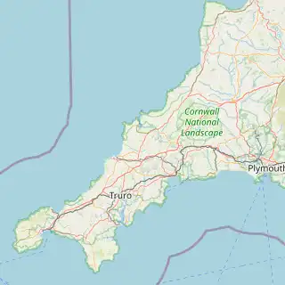
Map showing the location of this walk

Pubs on or near the route

  • The White Hart

either as a GPS-guided walk with our app (£3.39) or a PDF of directions (£2.79) Example of directions

Please recycle your ink cartridges to help prevent plastic fragments being ingested by seabirds. Google "Empties Please" to get freepost bags.