Walks around St Ives

Enjoy the walks by being guided by the app
-
2.7 miles/4.3 km - Easy
Hayle and The Towans

Hayle and The Towans
2.7 miles/4.3 km - Easy
A circular walk on the Towans at Hayle, where Cornwall's beam engines were cast using sand from a prehistoric lagoon when West Penwith was an island.
-
3.2 miles/5.2 km - Easy
St Erth, River and Pits

St Erth, River and Pits
3.2 miles/5.2 km - Easy
A circular walk from St Erth along the River Hayle, through woods and fields to Porthcollum then returning past the St Erth Pits nature reserve, with views over the Hayle valley which was once a lagoon separating an island of West Penwith from the Cornish mainland.
-
2.4 miles/3.8 km - Easy-moderate
Gwithian and Upton Towans
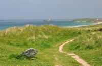
Gwithian and Upton Towans
2.4 miles/3.8 km - Easy-moderate
A circular walk around the nature reserve in the sand dunes that was once the National Explosives Works where girls manufactured dynamite from nitroglycerine.
-
3 miles/4.9 km - Easy-moderate
Baker's Pit and Rogers' Tower

Baker's Pit and Rogers' Tower
3 miles/4.9 km - Easy-moderate
A circular walk from the Bakers Pit nature reserve to an Iron Age hillfort where the remains of prehistoric roundhouses were seen as a convenient source of stone for a folly built in the era when the Poldark novels are set.
-
4.2 miles/6.8 km - Moderate
St Ives to Carbis Bay
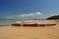
St Ives to Carbis Bay
4.2 miles/6.8 km - Moderate
A circular walk from St Ives through the Steeple Woods nature reserve to the monument overlooking St Ives Bay where the eccentric quinquennial ceremony of John Knill has been performed for over 200 years, returning along the coast via the white sandy beaches of Carbis Bay and Porthminster.
-
4.3 miles/7 km - Moderate
Lelant to St Ives

Lelant to St Ives
4.3 miles/7 km - Moderate
A one-way walk to St Ives along the beaches from Lelant including the vast expanse of Porthkidney Sands, Carbis Bay and Porthminster Beach using the train or bus to make the route almost circular.
-
4.3 miles/7 km - Moderate
St Ives
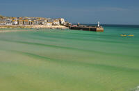
St Ives
4.3 miles/7 km - Moderate
A circular walk at St Ives along the granite coastline and white sandy beaches which have inspired so many artists, through some of the most famous parts of the town including the harbour, The Island and The Tate, and via the church and holy well of the Celtic girl Ia who, according to legend, was the first to settle here.
-
4.8 miles/7.7 km - Moderate
Lelant Saltings to Carbis Bay

Lelant Saltings to Carbis Bay
4.8 miles/7.7 km - Moderate
A circular walk from Lelant following St Michael's Way along the vast stretch of beach from Porthkidney Sands to Carbis Bay, with views over St Ives Bay on the return route.
-
5.0 miles/8.1 km - Moderate
Hell's Mouth to Godrevy
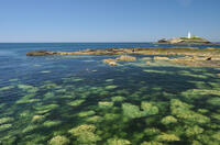
Hell's Mouth to Godrevy
5.0 miles/8.1 km - Moderate
A circular walk following the coast from Hell's Mouth past Godrevy lighthouse to the sandy beaches of St Ives Bay, returning via a pilgrimage route along the Red River Valley.
-
6.8 miles/11 km - Moderate
St Ives to Carn Naun
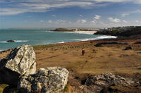
St Ives to Carn Naun
6.8 miles/11 km - Moderate
A circular walk from St Ives on the ancient churchway towards Zennor and returning along the rugged coast to Porthmeor, where a Victorian cargo ship and the St Ives lifeboat were both wrecked and the ship's boilers are still visible at low tide.
-
4.2 miles/6.8 km - Moderate-strenuous
Rosemergy to Gurnard's Head
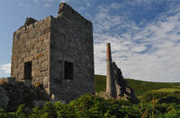
Rosemergy to Gurnard's Head
4.2 miles/6.8 km - Moderate-strenuous
A circular walk along the coast past the towering cliffs of Bosigran Castle via the white sand and huge boulders of Porthmeor Cove to the site of an Iron Age fort on Gurnard's Head, returning from the Gurnard's Head pub via the ancient Zennor Churchway.
-
4.2 miles/6.7 km - Moderate-strenuous
Zennor to Gurnard's Head
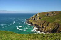
Zennor to Gurnard's Head
4.2 miles/6.7 km - Moderate-strenuous
A circular walk from Zennor along the coast to the site of an Iron Age fort on Gurnard's Head, returning from the Gurnard's Head pub on the ancient Churchway to Zennor.
-
5.4 miles/8.6 km - Moderate-strenuous
Zennor to The Carracks
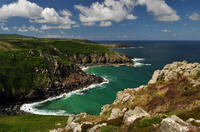
Zennor to The Carracks
5.4 miles/8.6 km - Moderate-strenuous
A circular walk towards St Ives from Zennor following the Coast Path past the haunts of the legendary mermaid of Zennor to the islets of The Carracks, frequented by seals, and returning on the Coffin Path, along which villagers made their final journey to Zennor church.
-
7.7 miles/12.4 km - Moderate-strenuous
Zennor to St Ives (via bus)
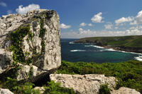
Zennor to St Ives (via bus)
7.7 miles/12.4 km - Moderate-strenuous
A fairly demanding but rewarding one-way coastal walk, made circular via an initial bus journey, along the rugged coast between St Ives and Zennor, passing Seal Island which may have given rise to the legend of the mermaid of Zennor and - thanks to some imaginative naming - ice cream (Moomaid of Zennor). The walk is in the optimal direction to remove time pressure and for panoramic views across St Ives bay.
-
12.1 miles/19.4 km - Moderate-strenuous
St Ives to Zennor
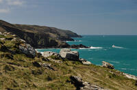
St Ives to Zennor
12.1 miles/19.4 km - Moderate-strenuous
A fairly long and demanding but rewarding circular walk along the coffin path and rugged coast between St Ives and Zennor. The walk is organised so that the coastal section is in the optimal direction for panoramic views across St Ives bay.
Download the iWalk Cornwall app and use the QR scanner within the app to find out more about any of the walks above.
The St Ives walk includes St Ives harbour, Smeaton's Pier, island and some of the coastline from St Ives to Zennor. Alternatively the walk from St Ives to Carbis Bay includes John Knill's Steeple and returns to St Ives via Porthminster Beach. On the walk from Lelant to Carbis Bay, you can walk for over a mile along the huge beach of Porth Kidney Sands if you time it for low tide.
For a fun way to explore St Ives as an outdoor escape room by solving puzzles to unlock a self-guided mystery tour, see the St Ives Mystery.


