Walks in Cornwall off the beaten track

Enjoy the walks by being guided by the app
These are good walks for getting away from the crowds during the holidays. During the summer there's a reasonable chance of some vegetation on some of the less well-used paths so it's not a bad plan to carry a stick/sickle and secateurs.
-
3.2 miles/5.2 km - Easy
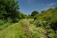
St Erth, River and Pits
St Erth, River and Pits
3.2 miles/5.2 km - Easy
A circular walk from St Erth along the River Hayle, through woods and fields to Porthcollum then returning past the St Erth Pits nature reserve, with views over the Hayle valley which was once a lagoon separating an island of West Penwith from the Cornish mainland.
-
2.4 miles/3.9 km - Easy-moderate
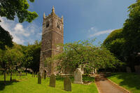
St Tudy to Wetherham
St Tudy to Wetherham
2.4 miles/3.9 km - Easy-moderate
A circular countryside walk from the 15th century church at St Tudy through the grounds of the 18th century Manor of Wetherham, returning to the church alehouse where ale brewed by the church was sold to raise funds, and later became the village lock-up known as The Clink.
-
2.6 miles/4.2 km - Easy-moderate
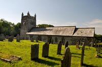
Warbstow Cross and Bury
Warbstow Cross and Bury
2.6 miles/4.2 km - Easy-moderate
A fairly short and easy circular walk around Warbstow, crossing ramparts of the massive Iron Age hillfort, through fields and along country lanes lined with wildflowers, returning via the mediaeval church which is dedicated to the daughter of a Saxon King who was tutored by the Celtic Saint Morwenna.
-
2.7 miles/4.4 km - Easy-moderate
Blisland to Lavethan Wood
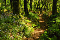
Blisland to Lavethan Wood
2.7 miles/4.4 km - Easy-moderate
A short circular walk from the village of Blisland through the churchyard, two stretches of the Woodland Trust reserve of Lavethan Wood and land which was once the estates of Lavethan and Barlandew manors.
-
2.7 miles/4.4 km - Easy-moderate
Gwennap Pit to Carn Marth (short version)
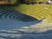
Gwennap Pit to Carn Marth (short version)
2.7 miles/4.4 km - Easy-moderate
A circular walk at Carn Marth with panoramic views right across mid-Cornwall to Falmouth and the Roseland, the Cornish Alps and Bodmin Moor, and St Agnes and Trevose Head
-
3.4 miles/5.5 km - Easy-moderate
Luxulyan Valley circular
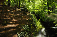
Luxulyan Valley circular
3.4 miles/5.5 km - Easy-moderate
A circular walk following the leats and horse-drawn tramways through the World Heritage site of the Luxulyan Valley to the massive viaduct which carried the tramways towards Newquay and water to winch the trams up the valley with a huge waterwheel, recommended in guidebooks as early as the 1920s "as one of the most glorious walks in all Cornwall".
-
3.6 miles/5.8 km - Easy-moderate
St Newlyn East and Lappa Valley
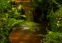
St Newlyn East and Lappa Valley
3.6 miles/5.8 km - Easy-moderate
A circular walk from St Newlyn East through the woods of the Lappa Valley where the Steam Railway now encompasses what was one of the most famous mines in Cornwall during Victorian times and the riverbeds are still stained red.
-
3.7 miles/6 km - Easy-moderate
St Just-in-Roseland to Messack Point
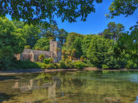
St Just-in-Roseland to Messack Point
3.7 miles/6 km - Easy-moderate
A circular walk on the Roseland along both sides of St Just creek to Messack Point, where there are spectacular views over one of the largest natural harbours in the world.
-
3.9 miles/6.2 km - Easy-moderate
Crowan to Clowance Estate
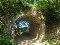
Crowan to Clowance Estate
3.9 miles/6.2 km - Easy-moderate
A circular walk in the parish of Crowan from the church to the Clowance Estate - the mansion of the St Aubyn Baronets until the fifth Baronet failed to produce a legitimate heir due to his 15 children all being born to women not married to him.
-
3.9 miles/6.2 km - Easy-moderate
Stannon Moor prehistoric relics
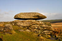
Stannon Moor prehistoric relics
3.9 miles/6.2 km - Easy-moderate
A circular walk around Stannon Moor near St Breward with panoramic views of Bodmin Moor, passing stone circles, burial chambers and other prehistoric monuments to a massive granite boulder balanced on Louden Hill which gently rocks if you sit on it.
-
4.1 miles/6.6 km - Easy-moderate
North Petherwin to Winsdon
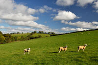
North Petherwin to Winsdon
4.1 miles/6.6 km - Easy-moderate
A circular walk from North Petherwin in the river valleys of the Bolsbridge Water.
-
4.4 miles/7 km - Easy-moderate
Giant's Quoit and Pendarves Wood
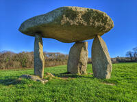
Giant's Quoit and Pendarves Wood
4.4 miles/7 km - Easy-moderate
A walk from a tiny village designed by Victorians, through ancient woodland that was once part of the Pendarves Estate to the prehistoric tomb that, despite two collapses over the centuries, is once again standing.
-
5 miles/8.1 km - Easy-moderate
Camelford to Watergate
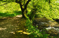
Camelford to Watergate
5 miles/8.1 km - Easy-moderate
A circular walk from Camelford through bluebell woods along the Camel valley to the Celtic churchyard of Advent and the Neolithic remains on the edge of Bodmin Moor.
-
5.1 miles/8.3 km - Easy-moderate
Deerpark to Herodsfoot
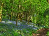
Deerpark to Herodsfoot
5.1 miles/8.3 km - Easy-moderate
A woodland walk in what's likely to have been a mediaeval deer park to the site of Cornwall's second-largest gunpowder manufacturing operation, which despite exploding several times was sufficiently successful to give rise to a nearby sister site known as Trago Mills.
-
5.1 miles/8.2 km - Easy-moderate
Polyphant
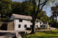
Polyphant
5.1 miles/8.2 km - Easy-moderate
A circular countryside walk to the mills in the Inny Valley from Polyphant, Cornish for "toad pool", to Gimblett's Mill where the bridge was rebuilt after a wall of water swept down the valley in 1847 destroying nearly everything in its path.
-
5.1 miles/8.2 km - Easy-moderate
St Breward to King Arthur's Hall
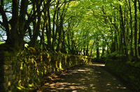
St Breward to King Arthur's Hall
5.1 miles/8.2 km - Easy-moderate
A circular walk from St Breward across the Treswallock Downs to the curious prehistoric structure of King Arthur's Hall and ending at the mediaeval Old Inn.
-
5.5 miles/8.8 km - Easy-moderate
Altarnun and West Moor
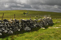
Altarnun and West Moor
5.5 miles/8.8 km - Easy-moderate
A walk at Altarnun across the downs and out onto the open moor where the relics of historic tin workings and prehistoric roundhouses can still be seen
-
5.8 miles/9.3 km - Easy-moderate
Castle-an-dinas and Menalhyl valley
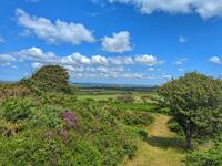
Castle-an-dinas and Menalhyl valley
5.8 miles/9.3 km - Easy-moderate
A mostly circular walk from the Castle-an-dinas Iron Age hillfort with 360 degree views across Cornwall, then into the valley to the River Menalhyl, followed by wooded paths lined with primroses, bluebells and wild garlic, and lanes with vibrant wildflowers.
-
6 miles/9.7 km - Easy-moderate
Three Saints Way
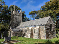
Three Saints Way
6 miles/9.7 km - Easy-moderate
A circular walk around the tributary valleys of the River Ottery and Kensey between three of Cornwall's least-well-known mediaeval churches
-
6.2 miles/10 km - Easy-moderate
Gwennap Pit and Carn Marth
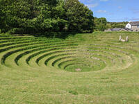
Gwennap Pit and Carn Marth
6.2 miles/10 km - Easy-moderate
A circular walk through an area steeped in mining history, with panoramic views from Carn Marth and the almost legendary Gwennap Pit which became so famous that even the neighbouring mine was renamed to Cathedral
-
2.7 miles/4.3 km - Moderate
Trebarwith Valley
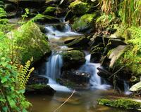
Trebarwith Valley
2.7 miles/4.3 km - Moderate
A fairly short circular walk exploring Trebarwith Valley, a designated Area of Outstanding Natural Beauty in North Cornwall. The walk includes bluebell woodland, panoramic views from both sides of the valley and the Trebarwith Nature Reserve.
-
2.9 miles/4.7 km - Moderate
Week St Mary to Penhallam
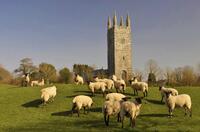
Week St Mary to Penhallam
2.9 miles/4.7 km - Moderate
A circular walk from the Saxon village of Week St Mary through Ashbury woods, beneath the Iron Age fort, to the remains of the mediaeval manor of Penhallam which was only rediscovered in the 1960s, returning via the church, repaired after the pinnacle above the door was severed by lightning and crashed through the roof.
-
3.1 miles/5.0 km - Moderate
St Breward to Lank
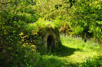
St Breward to Lank
3.1 miles/5.0 km - Moderate
A short circular walk from St Breward through ancient bluebell woods along the valley of the River Camel to the holy well, ending at the mediaeval church and inn.
-
3.5 miles/5.6 km - Moderate
Helman Tor and Red Moor
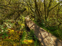
Helman Tor and Red Moor
3.5 miles/5.6 km - Moderate
A circular walk to the neolithic enclosure on the summit of Helman Tor and through the woodland of Cornwall's largest nature reserve.
-
3.6 miles/5.8 km - Moderate
Delabole

Delabole
3.6 miles/5.8 km - Moderate
A circular walk around Delabole past the slate quarry, along back lanes and tracks, and through fields and bluebell woods.
-
3.6 miles/5.7 km - Moderate
Withiel and Tremore Valley
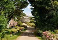
Withiel and Tremore Valley
3.6 miles/5.7 km - Moderate
A circular walk in the Ruthern and Tremore river valleys following the Saint's Way to Withiel where the award-winning cheese Cornish Yarg was first made from a recipe in a dusty book found in the attic, that is thought to date back to the 13th Century.
-
3.7 miles/5.9 km - Moderate
Sancreed to Carn Euny
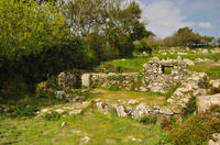
Sancreed to Carn Euny
3.7 miles/5.9 km - Moderate
A countryside walk to the Celtic church and Holy Well at Sancreed and the Iron Age village of Carn Euny where a well-preserved underground chamber known as a fogou has puzzled archaelogists for centuries
-
4 miles/6.5 km - Moderate
Bowithick to Buttern Hill
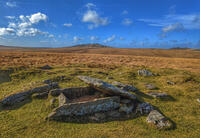
Bowithick to Buttern Hill
4 miles/6.5 km - Moderate
A circular walk over the northern tip of Bodmin Moor to the prehistoric burial chamber at the top of Buttern Hill and source of the River Fowey, returning via farm tracks and country lanes to the tributary streams of the River Inny.
-
4.2 miles/6.7 km - Moderate
Werrington to Bridgetown
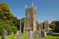
Werrington to Bridgetown
4.2 miles/6.7 km - Moderate
A circular walk through two tributary valleys of the River Tamar in a parish that was borrowed by Devon for 800 years, passing the remains of the wharf at the furthest reaches of the Bude Canal.
-
4.3 miles/6.9 km - Moderate
Treslea Downs and Warleggan
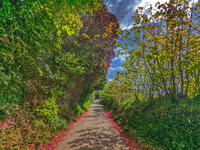
Treslea Downs and Warleggan
4.3 miles/6.9 km - Moderate
A circular walk at one of Cornwall's more remote and eccentric hamlets, displaying a "twinned with Narnia" sign and with a church where the vicar surrounded his rectory with barbed wire and preached to an empty church containing name cards of his parishioners
-
4.5 miles/7.2 km - Moderate
Porth Reservoir and Colan church
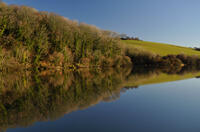
Porth Reservoir and Colan church
4.5 miles/7.2 km - Moderate
A circular walk through the wildlife reserve around the reservoir lake, past crumbling ruins of Fir Hill Manor and via farmland, a mill and wooded vales that were also once part of the great estate.
-
4.8 miles/7.8 km - Moderate
Luxulyan Valley to Prideaux
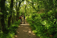
Luxulyan Valley to Prideaux
4.8 miles/7.8 km - Moderate
A circular walk through the World Heritage site of the Luxulyan Valley and surrounding countryside, over the massive viaduct supporting a horse-drawn tram route to Newquay and along the leat that fed Charlestown Harbour.
-
4.9 miles/7.8 km - Moderate
Ladock Woods and Holy Well
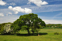
Ladock Woods and Holy Well
4.9 miles/7.8 km - Moderate
A circular walk from the woodland of The Duchy to the Holy Well of St Ladock in the river valley where in 1802 a gold nugget was found that contained enough gold to make an elegant necklace which is now in Truro museum.
-
5 miles/8 km - Moderate
Lesnewth to Tresparrett in the Valency Valley
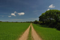
Lesnewth to Tresparrett in the Valency Valley
5 miles/8 km - Moderate
A circular walk in the upper reaches of the River Valency above Boscastle, where author Thomas Hardy lived and met the love of his life, starting from the ancient Celtic church of Lesnewth to St Juliot church which Hardy restored.
-
5.6 miles/9 km - Moderate
Delabole to Lanteglos
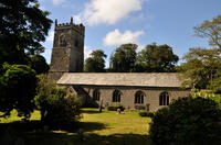
Delabole to Lanteglos
5.6 miles/9 km - Moderate
A circular walk through bluebell woodland, fields and along back lanes from Delabole to Camelford's parish church at Lanteglos, returning via the Iron Age forts of Castle Goff and Delinuth Camp.
-
5.6 miles/9.0 km - Moderate
St Clether to the Rising Sun
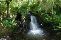
St Clether to the Rising Sun
5.6 miles/9.0 km - Moderate
A figure-of-8 walk from St Clether past the ancient chapel and holy well, with views over the Inny Valley, to the Rising Sun pub near Altarnun, serving beer made from the moorland springwater by a local micro-brewery.
-
5.7 miles/9.2 km - Moderate
Hellandbridge to St Mabyn
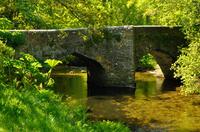
Hellandbridge to St Mabyn
5.7 miles/9.2 km - Moderate
A circular walk from Helland's mediaeval bridge through bluebell woodland and the fields overlooked by the Iron Age rounds at Pencarrow to the Norman church at St Mabyn, dedicated to the daughter of a Celtic King, and returning via the stump of the Neolithic Long Stone which stood for millennia until it was broken up for gateposts in 1850.
-
5.9 miles/9.5 km - Moderate
Carn Brea and the Great Flat Lode
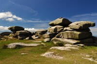
Carn Brea and the Great Flat Lode
5.9 miles/9.5 km - Moderate
A circular walk along the Great Flat Lode, where the Basset family made their fortune from the rich mineral reserves, to Carn Brea where they built a hunting lodge balanced on a tor in the style of a castle.
-
5.9 miles/9.5 km - Moderate
Trewarmett to Tregardock
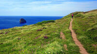
Trewarmett to Tregardock
5.9 miles/9.5 km - Moderate
A circular walk to the remote sandy beach at Tregardock, returning along the coast path with panoramic views of Port Isaac Bay, through the wildflowers of Treligga Downs and via Backways Cove.
-
6.1 miles/9.9 km - Moderate
St Wenn to Withiel
St Wenn to Withiel
6.1 miles/9.9 km - Moderate
A circular walk from St Wenn in the upper reaches of the Ruthern Valley, through Rosenannon woods and along the Saints' Way pilgrimage route to the mediaeval church at Withiel, where the Rector shut down The Pig and Whistle for being an ungodly establishment.
-
6.2 miles/10 km - Moderate
East Moor and Lynher Valleys
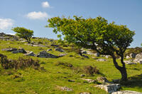
East Moor and Lynher Valleys
6.2 miles/10 km - Moderate
A circular walk in one of the less well-known areas of Bodmin Moor to the summit of Fox Tor and through the prehistoric remains which date from the Bronze Age and Neolithic times.
-
6.4 miles/10.3 km - Moderate
Pelynt and the West Looe Valley
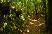
Pelynt and the West Looe Valley
6.4 miles/10.3 km - Moderate
A circular walk in the West Looe valley to St Nun's Well where it is said that if a bent pin is not left as an offering, clouds of piskies will accompany the visitor home and cause mischief.
-
6.4 miles/10.3 km - Moderate
St Breward to Advent
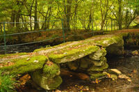
St Breward to Advent
6.4 miles/10.3 km - Moderate
A circular walk from St Breward past the granite pillars of Devil's Jump to the 8ft Celtic cross and ancient churchyard of Advent at the foot of the moors, returning via the remains of the mediaeval village of Carwether to the Inn used by 11th century monks to build the highest church in Cornwall.
-
6.5 miles/10.5 km - Moderate
Duloe to Herodsfoot
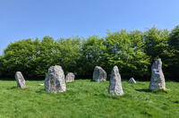
Duloe to Herodsfoot
6.5 miles/10.5 km - Moderate
A circular walk through the woodland along the West Looe River to Herodsfoot from Duloe, where Cornwall's smallest stone circle stands.
-
6.6 miles/10.6 km - Moderate
Inny Valleys from Altarnun
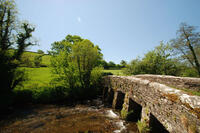
Inny Valleys from Altarnun
6.6 miles/10.6 km - Moderate
A circular walk around the valleys of the River Inny and Penpont Water to the mediaeval church at Laneast and the old bridge at Gimlett's Mill from the 15th century "Cathedral of the Moors" in Altarnun, set beside a 6th Century Celtic cross where churches and chapels had been throughout the Dark Ages.
-
3.7 miles/5.9 km - Moderate-strenuous
North Hill to Hawks Tor
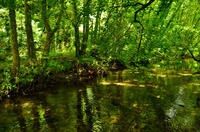
North Hill to Hawks Tor
3.7 miles/5.9 km - Moderate-strenuous
A circular walk along prehistoric trade routes in the Lynher valley from the village of North Hill where the granite was quarried to build Westminster Bridge.
-
4.3 miles/6.9 km - Moderate-strenuous
Blisland and Pendrift Downs
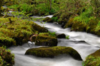
Blisland and Pendrift Downs
4.3 miles/6.9 km - Moderate-strenuous
A circular walk from Blisland through the De Lank granite quarry, used for many famous buildings including the Royal Opera House, between the moss-covered boulders and trees of the De Lank river valley and across the Pendrift Downs, passing Jubilee Rock - a huge granite boulder, decorated with carvings.
-
4.5 miles/7.2 km - Moderate-strenuous
Rilla Mill and Plushabridge
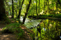
Rilla Mill and Plushabridge
4.5 miles/7.2 km - Moderate-strenuous
A circular walk from Rilla Mill with views across Cornwall to the Cheesewring and Kit Hill, and along the River Lynher through the Colquite Woodland reserve and via medieval bridges to where the ancient mill stood until the 1960s and the leats can still be seen.
-
5 miles/8 km - Moderate-strenuous
Kilkhampton to the Coombe valley
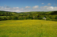
Kilkhampton to the Coombe valley
5 miles/8 km - Moderate-strenuous
A circular walk though the wildflowers of the Kilkhampton Common nature reserve and woods of the Coombe Valley, returning via the remains of the Norman castle at Penstowe which consisted of a stone tower perched on the top of a steep hill but surrounded by two baileys, rather than the usual one, the reason for which is a mystery.
-
5.1 miles/8.2 km - Moderate-strenuous
St Neot Two Valleys
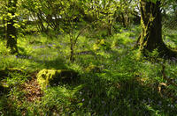
St Neot Two Valleys
5.1 miles/8.2 km - Moderate-strenuous
A circular walk from St Neot though the valley of the River Loveny, past a prehistoric settlement, through bluebell woodland and along the River Fowey, and returning via the church, famous for its mediaeval stained-glass.
-
5.4 miles/8.6 km - Moderate-strenuous
Duckpool to Woodford
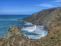
Duckpool to Woodford
5.4 miles/8.6 km - Moderate-strenuous
A circular walk in Morwenstow parish along towering cliffs and through broadleaf woods where a hamlet has been preserved in a joint project between the Landmark Trust and National Trust
-
6.4 miles/10.3 km - Moderate-strenuous
Cubert to St Piran's Round
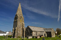
Cubert to St Piran's Round
6.4 miles/10.3 km - Moderate-strenuous
A circular walk from Cubert's Celtic churchyard through the cowslip meadows of the Penhale Sands nature reserve and on paths lined with wildflowers along the river valley to reach St Piran's Round - the remains of the mediaeval amphitheatre.
-
4.5 miles/7.3 km - Strenuous
St Gennys Church to Dizzard
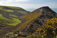
St Gennys Church to Dizzard
4.5 miles/7.3 km - Strenuous
A circular walk at St Gennys from the mediaeval church, via the smuggling routes though bluebell woods along the stream and an Iron Age clifftop fort crumbling into the sea, to some of North Cornwall's most remote coastline.
-
4.7 miles/7.6 km - Strenuous
Barrett's Zawn and Dannonchapel
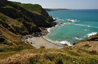
Barrett's Zawn and Dannonchapel
4.7 miles/7.6 km - Strenuous
A circular walk including some of the more remote parts of the coast path around Port Isaac Bay, passing the Donkey Hole at Barrett's Zawn and returning through the abandoned hamlet of Dannonchapel.
Download the iWalk Cornwall app and use the QR scanner within the app to find out more about any of the walks above.


