Walks around St Agnes

Enjoy the walks by being guided by the app
-
3.0 miles/4.9 km - Easy-moderate
St Agnes Beacon and Wheal Coates
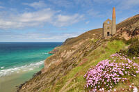
St Agnes Beacon and Wheal Coates
3.0 miles/4.9 km - Easy-moderate
A circular walk between St Agnes Head and the engine houses of Wheal Coates via St Agnes Beacon, with spectacular panoramic views
-
3.1 miles/4.9 km - Moderate
Trevaunance Cove and Blue Hills mine
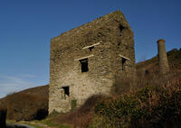
Trevaunance Cove and Blue Hills mine
3.1 miles/4.9 km - Moderate
A circular walk along the stream of Trevellas Coombe where tin ore is still worked using traditional water power, past Stippy Stappy - the row of sea captain's cottages, and down the valley to the sandy beach of Trevaunance Cove with the remains of Victorian harbour which was demolished by Atlantic storms.
-
4.7 miles/7.5 km - Moderate
Perranporth to St Agnes (via bus)
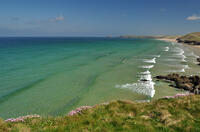
Perranporth to St Agnes (via bus)
4.7 miles/7.5 km - Moderate
A one-way coastal walk, made circular via an initial bus journey, along the ore-bearing cliffs between Perranporth and St Agnes passing the remains of Nobel's dynamite works, Britain's best preserved spitfire base and the Blue Hills of Trevellas Coombe where tin is still processed on a small scale using traditional methods.
-
4.7 miles/7.5 km - Moderate
Porthtowan to Chapel Porth
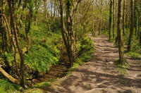
Porthtowan to Chapel Porth
4.7 miles/7.5 km - Moderate
A circular walk from Porthtowan, along the coast, valleys and woodland, passing engine houses and other relics of Cornish copper mining.
-
5 miles/8 km - Moderate
Callestick and Ventongimps

Callestick and Ventongimps
5 miles/8 km - Moderate
A circular countryside walk past the nature reserve at Ventongimps and the engine house of West Chyverton mine, with refreshment opportunities at both Callestick Farm, where you can see the ice cream being made, and Healey's Cyder Farm who offer tours and tasting.
-
5.7 miles/9.1 km - Moderate
Perranporth to Trevellas
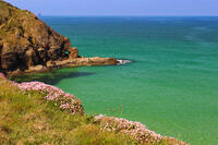
Perranporth to Trevellas
5.7 miles/9.1 km - Moderate
A circular walk past the remains of Alfred Nobel's dynamite works to the red-and-yellow ore-rich cliffs above the wreck of the treasure ship Hanover, returning, via the spitfire base, along Perran Coombe where a 2-mile leat once carried water to power a massive waterwheel in a chamber within the cliffs.
-
6.2 miles/10 km - Moderate
Chapel Porth to Trevaunance Cove
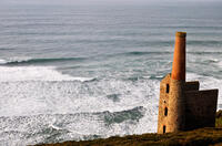
Chapel Porth to Trevaunance Cove
6.2 miles/10 km - Moderate
A circular walk along the coast between the golden sandy beaches of Chapel Porth and Trevaunance Cove at St Agnes via the iconic engine houses of Wheal Coates, perched above the breakers.
-
7.3 miles/11.7 km - Strenuous
Portreath to Wheal Tye
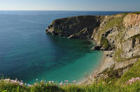
Portreath to Wheal Tye
7.3 miles/11.7 km - Strenuous
A circular walk along the rugged coast from Portreath towards Porthtowan passing small coves and remnants of the clifftop mines beside the old RAF base, and returning via the horse-drawn tramway that brought fortune to Portreath harbour, where its "lighthouse" and "monkey house" remain from the shipping activity.
Download the iWalk Cornwall app and use the QR scanner within the app to find out more about any of the walks above.
The walk from St Agnes to Trevallas Porth starts at Trevaunance Cove and ascends Trevellas Coombe. There is a longer coastal walk from Chapel Porth to St Agnes via the engine houses of Wheal Coates.
Southwest of St Agnes, the walk from Porthtowan to Chapel Porth includes Chapel Coombe and Banns Vale, and the walk from Portreath follows the coast towards Porthtowan. To the northeast of St Agnes, the walk from Perranporth to Trevellas includes Cligga Head and Hanover Cove.


