Circular walks around Wadebridge

Enjoy the walks by being guided by the app
-
2.4 miles/3.9 km - Easy-moderate
St Tudy to Wetherham
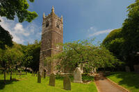
St Tudy to Wetherham
2.4 miles/3.9 km - Easy-moderate
A circular countryside walk from the 15th century church at St Tudy through the grounds of the 18th century Manor of Wetherham, returning to the church alehouse where ale brewed by the church was sold to raise funds, and later became the village lock-up known as The Clink.
-
3.8 miles/6.1 km - Easy-moderate
St Issey to Sea Mills
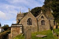
St Issey to Sea Mills
3.8 miles/6.1 km - Easy-moderate
A circular walk from St Issey along the river valley, the Saint's Way to the creek-side church at Little Petherick, and along the creek to the tidal enclosure of Sea Mills, returning via two old inns.
-
3.7 miles/5.9 km - Easy-moderate
St Mabyn to Pencarrow House

St Mabyn to Pencarrow House
3.7 miles/5.9 km - Easy-moderate
A fairly easy circular walk from St Mabyn past the church and through rolling countryside to Pencarrow House and its magnificent gardens.
-
5.2 miles/8.4 km - Easy-moderate
Wadebridge to St Breock
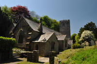
Wadebridge to St Breock
5.2 miles/8.4 km - Easy-moderate
A circular walk from Wadebridge on the Camel Trail alongside the Amble Marshes nature reserve then across meadows and wooded creeks to the mediaeval church of St Breock, returning via the woods of the Polmorla valley.
-
6.1 miles/9.7 km - Easy-moderate
Egloshayle and Allen Valley
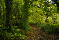
Egloshayle and Allen Valley
6.1 miles/9.7 km - Easy-moderate
A circular walk in the Allen Valley from Egloshayle though the broadleaf woodland alongside the River Allen past the mills of Hingham and Lemail to Dinham's Bridge, returning via the Celtic Three Holed Cross and the remains of Castle Killibury which from mediaeval Welsh texts is thought might be one of King Arthur's several castles.
-
6.8 miles/10.9 km - Easy-moderate
Wadebridge to Polbrock
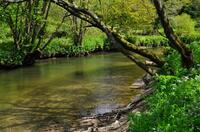
Wadebridge to Polbrock
6.8 miles/10.9 km - Easy-moderate
A circular walk from Wadebridge through the Treraven nature reserve, bluebell woodland at Hustyn Mill and meadows along the River Camel to Polbrock, returning along the Camel Trail.
-
3.6 miles/5.7 km - Moderate
Withiel and Tremore Valley
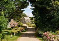
Withiel and Tremore Valley
3.6 miles/5.7 km - Moderate
A circular walk in the Ruthern and Tremore river valleys following the Saint's Way to Withiel where the award-winning cheese Cornish Yarg was first made from a recipe in a dusty book found in the attic, that is thought to date back to the 13th Century.
-
5.3 miles/8.6 km - Moderate
Little Petherick Creek and the Camel Trail
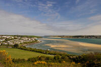
Little Petherick Creek and the Camel Trail
5.3 miles/8.6 km - Moderate
A circular walk via the Victorian obelisk overlooking Padstow, the creek-side church at Little Petherick and the tidal enclosure of Sea Mills, returning via the Camel Trail bridge which carried the railway that brought the first Victorian tourists to Padstow and Cornish fish to London.
-
5.5 miles/8.9 km - Moderate
St Kew, St Endellion and Tregellist
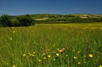
St Kew, St Endellion and Tregellist
5.5 miles/8.9 km - Moderate
A circular walk in the river valleys around St Kew - the first recorded village in Cornwall, passing the mediaeval church containing a gravestone from the Dark Ages carved in Latin and the Celtic script, Ogham, also known as the Tree Alphabet as each letter symbolised a different species of tree.
-
5.7 miles/9.2 km - Moderate
Hellandbridge to St Mabyn
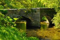
Hellandbridge to St Mabyn
5.7 miles/9.2 km - Moderate
A circular walk from Helland's mediaeval bridge through bluebell woodland and the fields overlooked by the Iron Age rounds at Pencarrow to the Norman church at St Mabyn, dedicated to the daughter of a Celtic King, and returning via the stump of the Neolithic Long Stone which stood for millennia until it was broken up for gateposts in 1850.
-
6.1 miles/9.9 km - Moderate
St Wenn to Withiel
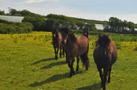
St Wenn to Withiel
6.1 miles/9.9 km - Moderate
A circular walk from St Wenn in the upper reaches of the Ruthern Valley, through Rosenannon woods and along the Saints' Way pilgrimage route to the mediaeval church at Withiel, where the Rector shut down The Pig and Whistle for being an ungodly establishment.
Download the iWalk Cornwall app and use the QR scanner within the app to find out more about any of the walks above.
For some walks starting at Wadebridge, Wadebridge to Polbrock goes up the Camel Valley and Wadebridge to St Breock follows the Camel Trail into the estuary before crossing inland to return via the Polmorla valley.


