Moorland walks in Cornwall

Enjoy the walks by being guided by the app
-
3 miles/4.9 km - Easy-moderate
Baker's Pit and Rogers' Tower
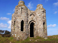
Baker's Pit and Rogers' Tower
3 miles/4.9 km - Easy-moderate
A circular walk from the Bakers Pit nature reserve to an Iron Age hillfort where the remains of prehistoric roundhouses were seen as a convenient source of stone for a folly built in the era when the Poldark novels are set.
-
3.9 miles/6.2 km - Easy-moderate
Stannon Moor prehistoric relics
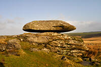
Stannon Moor prehistoric relics
3.9 miles/6.2 km - Easy-moderate
A circular walk around Stannon Moor near St Breward with panoramic views of Bodmin Moor, passing stone circles, burial chambers and other prehistoric monuments to a massive granite boulder balanced on Louden Hill which gently rocks if you sit on it.
-
4.2 miles/6.8 km - Easy-moderate
Davidstow and Inny Vale
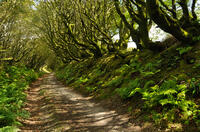
Davidstow and Inny Vale
4.2 miles/6.8 km - Easy-moderate
A circular walk in the Inny Vale on the northern edge of Bodmin Moor through the WW2 airbase on Davidstow Moor, the tunnel of trees to Treworra and past the source of the River Inny to the church and holy well of St David.
-
5 miles/8.1 km - Easy-moderate
Camelford to Watergate
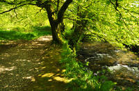
Camelford to Watergate
5 miles/8.1 km - Easy-moderate
A circular walk from Camelford through bluebell woods along the Camel valley to the Celtic churchyard of Advent and the Neolithic remains on the edge of Bodmin Moor.
-
5 miles/8 km - Easy-moderate
Minions and Caradon Hill
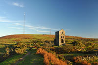
Minions and Caradon Hill
5 miles/8 km - Easy-moderate
A walk through the remains of the UK's most productive copper mines which employed thousands of people in Victorian times, including brakemen who each scooted an individual loaded ore wagon down to Liskeard on the railway that forms much of the walk route.
-
5.1 miles/8.2 km - Easy-moderate
St Breward to King Arthur's Hall
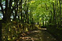
St Breward to King Arthur's Hall
5.1 miles/8.2 km - Easy-moderate
A circular walk from St Breward across the Treswallock Downs to the curious prehistoric structure of King Arthur's Hall and ending at the mediaeval Old Inn.
-
5.5 miles/8.8 km - Easy-moderate
Altarnun and West Moor
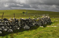
Altarnun and West Moor
5.5 miles/8.8 km - Easy-moderate
A walk at Altarnun across the downs and out onto the open moor where the relics of historic tin workings and prehistoric roundhouses can still be seen
-
3.5 miles/5.6 km - Moderate
Helman Tor and Red Moor
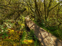
Helman Tor and Red Moor
3.5 miles/5.6 km - Moderate
A circular walk to the neolithic enclosure on the summit of Helman Tor and through the woodland of Cornwall's largest nature reserve.
-
3.8 miles/6.8 km - Moderate
Minions and the Cheesewring
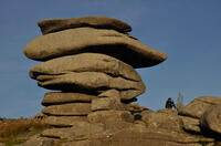
Minions and the Cheesewring
3.8 miles/6.8 km - Moderate
A circular walk around the iconic landmarks at Minions, including The Hurlers stone circles, The Cheesewring and the engine houses of the South Phoenix Mine.
-
4 miles/6.5 km - Moderate
Bowithick to Buttern Hill
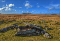
Bowithick to Buttern Hill
4 miles/6.5 km - Moderate
A circular walk over the northern tip of Bodmin Moor to the prehistoric burial chamber at the top of Buttern Hill and source of the River Fowey, returning via farm tracks and country lanes to the tributary streams of the River Inny.
-
5.2 miles/8.4 km - Moderate
Poley's Bridge to Blisland
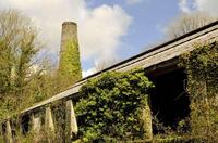
Poley's Bridge to Blisland
5.2 miles/8.4 km - Moderate
A circular walk from Poley's Bridge along the Camel Trail past the old china clay driers to Wenfordbridge and crossing the De Lank valley and Pendrift Downs to Blisland, returning along the Camel valley.
-
6.2 miles/10 km - Moderate
East Moor and Lynher Valleys
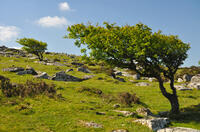
East Moor and Lynher Valleys
6.2 miles/10 km - Moderate
A circular walk in one of the less well-known areas of Bodmin Moor to the summit of Fox Tor and through the prehistoric remains which date from the Bronze Age and Neolithic times.
-
6.4 miles/10.3 km - Moderate
St Breward to Advent
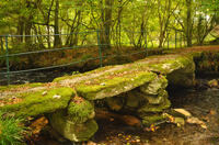
St Breward to Advent
6.4 miles/10.3 km - Moderate
A circular walk from St Breward past the granite pillars of Devil's Jump to the 8ft Celtic cross and ancient churchyard of Advent at the foot of the moors, returning via the remains of the mediaeval village of Carwether to the Inn used by 11th century monks to build the highest church in Cornwall.
-
7.1 miles/11.5 km - Moderate
Portheras Cove and Chûn Quoit
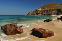
Portheras Cove and Chûn Quoit
7.1 miles/11.5 km - Moderate
A circular walk along the coast to the white, sandy beach of Portheras Cove and across the Penwith Moors to a prehistoric tomb the age of the Egyptian Pyramids
-
4.3 miles/6.9 km - Moderate-strenuous
Blisland and Pendrift Downs
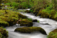
Blisland and Pendrift Downs
4.3 miles/6.9 km - Moderate-strenuous
A circular walk from Blisland through the De Lank granite quarry, used for many famous buildings including the Royal Opera House, between the moss-covered boulders and trees of the De Lank river valley and across the Pendrift Downs, passing Jubilee Rock - a huge granite boulder, decorated with carvings.
-
5.2 miles/8.4 km - Moderate-strenuous
Rough Tor and Brown Willy
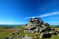
Rough Tor and Brown Willy
5.2 miles/8.4 km - Moderate-strenuous
A mostly circular walk to Cornwall's two highest tors, passing prehistoric remains including the holy well, summit cairns and settlements.
-
5.5 miles/8.8 km - Moderate-strenuous
Carn Galver to Mên-an-Tol
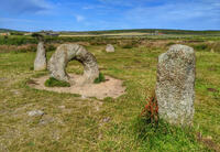
Carn Galver to Mên-an-Tol
5.5 miles/8.8 km - Moderate-strenuous
A circular walk from the coast to the highest area of moor on West Penwith passing engine houses and prehistoric monuments and with spectacular heather in late summer
Download the iWalk Cornwall app and use the QR scanner within the app to find out more about any of the walks above.


