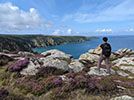
Circular walks in South Coast Western AONB
Enjoy the walks by being guided by the app
-
3.3 miles/5.3 km - Easy-moderate
Penrose to the Loe Bar
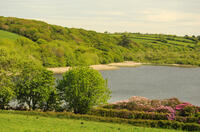
Penrose to the Loe Bar
3.3 miles/5.3 km - Easy-moderate
A circular walk alongside the Loe Pool to the Loe Bar and back via the farm on the hill spur, which in Cornish gave the name to the Penrose Estate.
-
3.3 miles/5.2 km - Easy-moderate
St Keverne to Porthallow
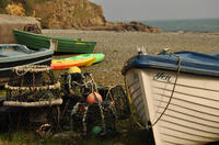
St Keverne to Porthallow
3.3 miles/5.2 km - Easy-moderate
A circular walk through woods and meadows to Porthoustock and Porthallow from St Keverne, settled in the Dark Ages by Celtic monks trading with Brittany
-
3.5 miles/5.6 km - Easy-moderate
Mawnan
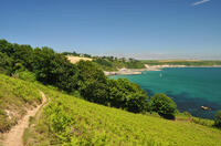
Mawnan
3.5 miles/5.6 km - Easy-moderate
A circular walk through three of the wooded valleys to the sheltered coves at the mouth of the Helford River
-
4.5 miles/7.2 km - Easy-moderate
Kennack Sands to Cadgwith
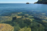
Kennack Sands to Cadgwith
4.5 miles/7.2 km - Easy-moderate
A circular walk from Kennack Sands to Cadgwith Cove via the Poltesco valley where during Victorian times waterwheels and steam engines powered an industry producing large decorative pieces of serpentine but has now been recolonised by nature
-
4.6 miles/7.4 km - Easy-moderate
Helford to Dennis Head
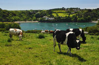
Helford to Dennis Head
4.6 miles/7.4 km - Easy-moderate
A circular walk around the creeks of the Helford River and the small villages settled by Celtic monks from Brittany.
-
4.9 miles/7.9 km - Easy-moderate
Marazion to Perranuthnoe
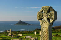
Marazion to Perranuthnoe
4.9 miles/7.9 km - Easy-moderate
A mostly circular walk to Perranuthnoe beach from one of Britain's most ancient towns - Marazion - burnt down twice by the French and once more in a Cornish rebellion
-
5.8 miles/9.4 km - Easy-moderate
Rosemullion Head
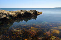
Rosemullion Head
5.8 miles/9.4 km - Easy-moderate
A circular walk passing the National Trust's Glendurgan gardens and the equally spectacular submarine gardens of Rosemullion Head where fish dart amongst the brightly-coloured blooms.
-
6 miles/9.6 km - Easy-moderate
Penrose and Porthleven
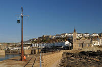
Penrose and Porthleven
6 miles/9.6 km - Easy-moderate
A circular walk through the woodland alongside the Loe to the most southerly port on the British mainland, famous for its huge storm waves.
-
6.2 miles/10 km - Easy-moderate
The Loe
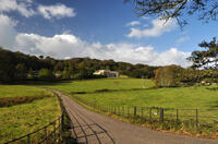
The Loe
6.2 miles/10 km - Easy-moderate
A circular walk around the Loe Pool, the largest natural freshwater lake in Cornwall, and along the Loe Bar, one of Cornwall's most treacherous beaches on which 100 of those onboard the HMS Anson drowned metres from the shore, motivating the invention of the rocket lifesaving apparatus that saved thousands of lives.
-
3.2 miles/5.1 km - Moderate
Lizard to Kynance Cove (shorter version)
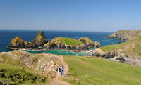
Lizard to Kynance Cove (shorter version)
3.2 miles/5.1 km - Moderate
A circular walk from Lizard village to Kynance Cove with spectacular views, wildflowers including Cornwall's county flower and wildlife including the Cornish Chough.
-
3.8 miles/6.1 km - Moderate
Helford and Frenchman's Creek
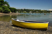
Helford and Frenchman's Creek
3.8 miles/6.1 km - Moderate
A circular walk through the wooded valleys of the Helford River including the most famous - Frenchman's Creek - which is still as pristine as when it inspired Daphne du Maurier's novel
-
3.8 miles/6.1 km - Moderate
Church Cove and Lizard Point
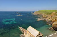
Church Cove and Lizard Point
3.8 miles/6.1 km - Moderate
A circular walk on The Lizard to the most southerly point from Church Cove, where the Lizard lifeboat is now launched to the old lifeboat station at Polpeor Cove.
-
3.9 miles/6.3 km - Moderate
Perranuthnoe to Prussia Cove
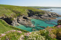
Perranuthnoe to Prussia Cove
3.9 miles/6.3 km - Moderate
A circular walk along Mount's Bay from the large sandy beach at Perranuthnoe to the smugglers' coves at Prussia Cove, returning across the fields with views over St Michael's Mount.
-
4.1 miles/6.5 km - Moderate
Cadgwith Cove to Church Cove
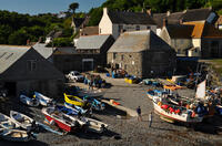
Cadgwith Cove to Church Cove
4.1 miles/6.5 km - Moderate
A circular walk on the serpentine coast of The Lizard from Cadgwith Cove to Church Cove, returning via two ancient churches and the holy well of St Ruan.
-
4.4 miles/7 km - Moderate
Kennack Sands to Lankidden Cove
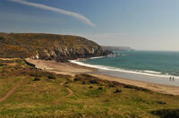
Kennack Sands to Lankidden Cove
4.4 miles/7 km - Moderate
A circular walk on The Lizard from Kennack Sands where some of the oldest prehistoric finds have been made in Cornwall, including an entire lost Stone Age village which was uncovered by a gorse fire in the 1960s.
-
4.4 miles/7.1 km - Moderate
The Lizard and Kynance Cove
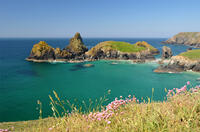
The Lizard and Kynance Cove
4.4 miles/7.1 km - Moderate
A circular walk along the Victorian Excursion route from Lizard village to the most southerly point and along the coast path to Kynance Cove with spectacular views, wildflowers, and wildlife including the Cornish Chough.
-
4.4 miles/7.1 km - Moderate
Porthallow to Gillan
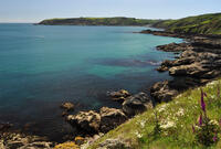
Porthallow to Gillan
4.4 miles/7.1 km - Moderate
A circular walk up Gillan Creek from Porthallow via Nare Point where, during World War II, an elaborate decoy for Falmouth Harbour was created by Ealing Film Studios with fake railways, houses and explosive special effects.
-
4.5 miles/7.2 km - Moderate
Mullion three coves
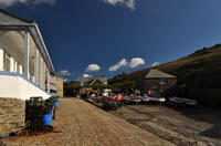
Mullion three coves
4.5 miles/7.2 km - Moderate
A walk to the Victorian harbour of Mullion Cove via two sandy coves either side of where Marconi made history by achieving what was thought impossible by many of the scientific community at the time - the transmission of a radio signal all the way across the Atlantic.
-
5.1 miles/8.2 km - Moderate
Predannack to Kynance Cove
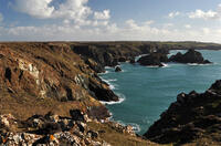
Predannack to Kynance Cove
5.1 miles/8.2 km - Moderate
A circular walk through the Lizard National Nature Reserve from Predannack to Kynance Cove along the rugged Serpentine cliffs where the "great silver ship" was wrecked in 1616 and more than 700 Spanish silver coins have so far been found.
-
5.3 miles/8.5 km - Moderate
Gunwalloe Coves
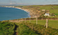
Gunwalloe Coves
5.3 miles/8.5 km - Moderate
A circular walk from the Loe Bar to Dollar Cove passing the wrecks of treasure ships whose cargo still washes ashore, returning via the Halzephron Inn which still has a trapdoor leading to an underground network of tunnels used by smugglers.
-
5.7 miles/9.2 km - Moderate
Coverack to St Keverne
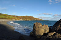
Coverack to St Keverne
5.7 miles/9.2 km - Moderate
A circular walk from Coverack to St Keverne, past the treacherous Manacles reef, known as the grave of a thousand ships, where at least a hundred wrecks have been recorded and over a thousand people have drowned.
-
6.2 miles/10 km - Moderate
Mullion to Predannack
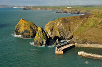
Mullion to Predannack
6.2 miles/10 km - Moderate
A circular walk passing the sandy beach at Polurrian Cove, the storm-beaten Victorian harbour at Mullion Cove, and along the cliffs of the National Nature Reserve overlooking Mullion Island, with vibrant wildflowers in spring and summer.
-
6.3 miles/10.1 km - Moderate
Helford Passage
Helford Passage
6.3 miles/10.1 km - Moderate
A circular walk on the Helford River, where the mild climate and south-facing slopes allow subtropical plants collected by Victorian expeditions to flourish in the gardens of Glendurgan and Trebah.
-
7 miles/11.3 km - Moderate
Cadgwith Cove to The Lizard
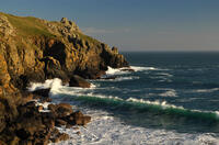
Cadgwith Cove to The Lizard
7 miles/11.3 km - Moderate
A circular walk on The Lizard from the pretty fishing hamlet of Cadgwith Cove, past the Devil's Frying Pan, lifeboat station, restored Marconi wireless hut and the infamous lighthouse, to the most southerly point, returning via two ancient churches and the holy well dedicated to the Celtic Saint accused of being a werewolf.
-
7.2 miles/11.5 km - Moderate
Maenporth to Budock Water
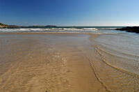
Maenporth to Budock Water
7.2 miles/11.5 km - Moderate
A circular walk between the beaches in Falmouth Bay and where one of the most dangerous marine rescues of modern times took place, requiring the rescue helicopter to fly backwards.
-
7.6 miles/12.3 km - Moderate
Poldhu Cove to Cury
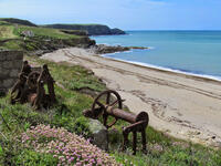
Poldhu Cove to Cury
7.6 miles/12.3 km - Moderate
A circular walk via some of the mediaeval farmsteads on the west of The Lizard to the ancient churchyard of Cury from the coves of Mullion and Gunwalloe where the wrecks of treasure ships still lie.
-
6.8 miles/10.9 km - Moderate-strenuous
Porthleven to Rinsey Head
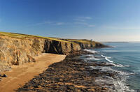
Porthleven to Rinsey Head
6.8 miles/10.9 km - Moderate-strenuous
A circular walk from Porthleven to the cliff-edge engine houses of Rinsey Head and Trewavas where the under-sea mine, set out with tables and food for the annual Tribute dinner, is said to have been breached by the sea just minutes before all the miners were due underground.
-
7.3 miles/11.8 km - Moderate-strenuous
Coverack to Lankidden Cove
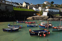
Coverack to Lankidden Cove
7.3 miles/11.8 km - Moderate-strenuous
A circular walk on one of the most remote parts of The Lizard from Coverack to the white sand beaches of Downas and Lankidden Coves, where the serpentine underwater landscape provides some of the best snorkelling in Cornwall.
Download the iWalk Cornwall app and use the QR scanner within the app to find out more about any of the walks above.
