Harlyn Bay

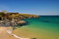
Harlyn Bay faces Northeast which means that the prevailing southwesterly winds are offshore. This is very good news for surfing, but due to the sheltered location it needs a good size swell to produce surf of any size. The best waves are reported to be at mid tide.
The original name was Ar-Lyn which is Cornish for "facing the lake". This is presumably based on the bay facing away from the prevailing wind and therefore having calm waters. The "h" seems to have been gained during mediaeval times after the Norman conquest when the land-owning gentry didn't speak Cornish.
- Tide times
- Beach info
- Map
- Dogs: allowed all year
Walks visiting Harlyn Bay
-
6.1 miles/9.7 km - Easy-moderate
Trevose Head

Trevose Head
6.1 miles/9.7 km - Easy-moderate
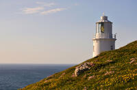
A circular walk around the rugged coastline of Trevose Head via the iconic lighthouse and golden sandy bays of Constantine, Booby's, Mother Ivey's and Harlyn, with spectacular wildflowers in spring and summer.
-
6.8 miles/10.9 km - Easy-moderate
Seven Bays (via bus)

Seven Bays (via bus)
6.8 miles/10.9 km - Easy-moderate
A one-way coastal walk, made circular via an initial bus journey, along the Seven Bays coast and around Trevose Head past the lighthouse.
-
6.7 miles/10.7 km - Moderate
Harlyn Bay to Padstow (via bus)

Harlyn Bay to Padstow (via bus)
6.7 miles/10.7 km - Moderate
A one-way coastal walk, made circular via an initial bus journey, from Harlyn Bay to Padstow via Trevone, Stepper Point - where a huge stone tower stands as a daymark, the Doom Bar and the sandy coves of Hawker's, Harbour and St George's which join into a single huge beach at low tide.
Download the iWalk Cornwall app and use the QR scanner within the app to find out more about any of the walks above.

