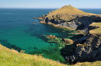
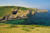
Pentireglaze Haven beach

At high tide, Pentireglaze Haven is a small, sandy beach. As the tide goes out, it merges with Polzeath to a large stretch of sand. The beach is a letterbox shape, enclosed by the headland to the north and by the rocky platform of New Polzeath to the south so it's a little more sheltered than Polzeath but still faces west into the surf.
- Tide times
- Map
- Dogs: restricted times
Walks visiting Pentireglaze Haven beach
-
4.2 miles/6.7 km - Moderate
The Rumps to Polzeath around Pentire Point

The Rumps to Polzeath around Pentire Point
4.2 miles/6.7 km - Moderate
A circular walk across the Iron Age hillfort on the twin headlands of The Rumps and around Pentire Point, with panoramic views of the Camel Estuary and the offshore islands, to the sandy beach at Polzeath.
-
9.9 miles/15.9 km - Moderate-strenuous
Port Isaac to Polzeath (via bus)

Port Isaac to Polzeath (via bus)
9.9 miles/15.9 km - Moderate-strenuous
A one-way coastal walk, made circular via an initial bus journey, from Port Isaac to Polzeath along the Rollercoaster Path to Port Quin, the golden beaches of Lundy Bay via the Iron Age hillfort on the twin headland of The Rumps.
Download the iWalk Cornwall app and use the QR scanner within the app to find out more about any of the walks above.


