Perranporth beach

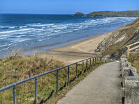
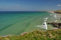
At high tide, there are two distinct beaches within Perran Bay: the long, thin Perran Beach (also known as Perran Sands) to the north, between Carn Clew and Ligger Point, and the smaller Perranporth beach to the south between Cotty's Point and the river beside Chapel Rock. At low tide, the beaches combine into a 2.2 mile stretch of sand between Droksyn Point and Ligger Point, up to a quarter of a mile wide. There is a tidal swimming pool on the seaward side of Chapel Rock (the one with the flag on). The northern end of the beach is generally much quieter due to the town of Perranporth and associated holiday parks being at the southern end of the beach, and much of the dunes to the north (known as Penhale Sands) being military land with no public access. Even when the tide is too far in to walk along the beach, most of the time it's still possible to reach the other half via the coast path.
- Tide times
- Beach info
- Map
- Dogs: allowed all year
Walks visiting Perranporth beach
-
3.6 miles/5.8 km - Easy-moderate
Lost Church and Perranporth dunes

Lost Church and Perranporth dunes
3.6 miles/5.8 km - Easy-moderate
A circular walk on the highest dune system in Britain to the chapel dating from Celtic times which was lost in the dunes for nearly 1000 years.
-
4.7 miles/7.5 km - Moderate
Perranporth to St Agnes (via bus)

Perranporth to St Agnes (via bus)
4.7 miles/7.5 km - Moderate
A one-way coastal walk, made circular via an initial bus journey, along the ore-bearing cliffs between Perranporth and St Agnes passing the remains of Nobel's dynamite works, Britain's best preserved spitfire base and the Blue Hills of Trevellas Coombe where tin is still processed on a small scale using traditional methods.
-
5.7 miles/9.1 km - Moderate
Perranporth to Trevellas

Perranporth to Trevellas
5.7 miles/9.1 km - Moderate
A circular walk past the remains of Alfred Nobel's dynamite works to the red-and-yellow ore-rich cliffs above the wreck of the treasure ship Hanover, returning, via the spitfire base, along Perran Coombe where a 2-mile leat once carried water to power a massive waterwheel in a chamber within the cliffs.
-
7.4 miles/11.9 km - Moderate
Holywell to St Piran's Oratory

Holywell to St Piran's Oratory
7.4 miles/11.9 km - Moderate
A circular walk from Holywell Bay along the rugged coastline to Perran Beach and across the dunes to the mediaeval relics of St Piran's Oratory, Church and Cross, returning via the Penhale Sands nature reserve which is carpeted in cowslips during spring.
Download the iWalk Cornwall app and use the QR scanner within the app to find out more about any of the walks above.
For a circular route that goes through Perranporth itself, there is a walk from Perranporth to Trevellas via Cligga Head. For a circular route that includes St Piran's Oratory, there is a walk from Holywell Bay to St Piran's Oratory via Ligger Point, returning via Penhale Sands. There is a also a circular walk from Cubert church to St Piran's Round.

