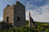
Porthmeor Cove

Porthmeor Cove is a Site of Special Scientific Interest due to its geology. In fact it is cited as one of the most important geological locations in Southwest England. It lies on the boundary of the West Penwith granite and the effects of the molten granite intruding into the surrounding rocks can be seen quite clearly here as the granite is a light colour and the surrounding slate is much darker. Along one side of the cove, a round area of granite can be seen, completely surrounded by darker rock. This is known as a cupola, where the blob of granite rose up from below rather like in a lava lamp. Leading from this are thin bands where the molten granite forced its way along cracks in the bedrock.
At first glance, the beach name is easily confused with the far more well-known Porthmeor beach at St Ives - this one is between Zennor and Morvah. The reason for the similarity is that porthmeor is Cornish for "big cove". In this case, an additional "Cove" was likely added for good measure by a Victorian gentlemen working for the Ordnance Survey who didn't understand Cornish so the name is now "big cove cove".
- Tide times
- Beach info
- Map
- Dogs: allowed all year
Circular walks visiting Porthmeor Cove
-
4.2 miles/6.8 km - Moderate-strenuous
Rosemergy to Gurnard's Head

Rosemergy to Gurnard's Head
4.2 miles/6.8 km - Moderate-strenuous
A circular walk along the coast past the towering cliffs of Bosigran Castle via the white sand and huge boulders of Porthmeor Cove to the site of an Iron Age fort on Gurnard's Head, returning from the Gurnard's Head pub via the ancient Zennor Churchway.
Download the iWalk Cornwall app and use the QR scanner within the app to find out more about any of the walks above.

