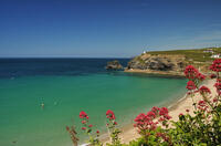
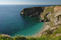
Portreath beach

Portreath beach faces NNW so it is relatively sheltered from prevailing southwesterlies by Western Hill. Southerly or southeasterly winds provide the best surf conditions.
Beneath the beach at Portreath are the remains of a submerged forest. During the 1980s, the beach was scoured by a storm and this was uncovered. The remains consisted of tree roots and fragments of wood set in peat.
Circular walks visiting Portreath beach
-
5.2 miles/8.4 km - Moderate-strenuous
Portreath and Tehidy Woods

Portreath and Tehidy Woods
5.2 miles/8.4 km - Moderate-strenuous
A circular walk along the rugged North Cliffs hiding smuggler's coves such as Ralph's Cupboard, to the sandy beach and historic mining port of Portreath, returning via the bluebell woodland of Illogan and Tehidy Country Park.
-
7.3 miles/11.7 km - Strenuous
Portreath to Wheal Tye

Portreath to Wheal Tye
7.3 miles/11.7 km - Strenuous
A circular walk along the rugged coast from Portreath towards Porthtowan passing small coves and remnants of the clifftop mines beside the old RAF base, and returning via the horse-drawn tramway that brought fortune to Portreath harbour, where its "lighthouse" and "monkey house" remain from the shipping activity.
Download the iWalk Cornwall app and use the QR scanner within the app to find out more about any of the walks above.
For walks passing through Portreath, there are a couple of options: the walk from Portreath to Tobban Horse follows the coast towards Porthtowan and returns via the mineral tramways; alternatively you can park at the Tehidy North Cliffs car park and walk to Portreath along the North Cliffs, returning via Illogan Woods and Tehidy Country Park.
Some slightly less strenuous walks are from the Tehidy Country Park to Deadman's Cove via Coombe or from Deadman's Cove to Hell's Mouth along the North Cliffs and return along the Red River valley to Coombe. Finally there is a walk from Hell's Mouth to Godrevy Point with excellent views of the lighthouse.


