The Strangles beach

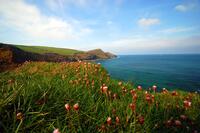
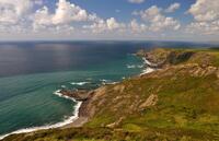
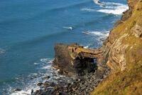
The Strangles gets its name due to the treacherous currents and jagged rocks that have wrecked many ships trying to navigate the rocky coastline of North Cornwall. This is not a safe beach for swimming unless the sea is completely calm without much surf. There is spectacular scenery both on the walk down and from the beach itself including a rock arch and the cliffs are covered with gorse and heather flowers in early autumn.
The Strangles is a beach between Boscastle and Crackington Haven that is reached via a public footpath crossing the Coast Path.
- Tide times
- Beach info
- Map
- Dogs: allowed all year
Walks visiting The Strangles beach
-
4.3 miles/6.9 km - Moderate-strenuous
Crackington Haven to The Strangles

Crackington Haven to The Strangles
4.3 miles/6.9 km - Moderate-strenuous
A circular walk from Crackington Haven, with panoramic views of the Shipwreck Coast, to the long, sandy Strangles beach, returning through bluebell woodland along the Ludon river valley.
-
4.9 miles/7.8 km - Moderate-strenuous
The Strangles to Buckator

The Strangles to Buckator
4.9 miles/7.8 km - Moderate-strenuous
A circular walk along the volcanic coastline north of Boscastle, including Cornwall's highest cliff and The Strangles beach with its spectacular arch known as the Northern Door.
-
7 miles/11.2 km - Strenuous
Crackington Haven to Boscastle (via bus)

Crackington Haven to Boscastle (via bus)
7 miles/11.2 km - Strenuous
A one-way coastal walk, made circular via an initial bus journey, along the Shipwreck Coast from Crackington Haven to Boscastle passing the highest cliff in Cornwall and the long, sandy beach at The Strangles.
Download the iWalk Cornwall app and use the QR scanner within the app to find out more about any of the walks above.

