Tintagel Haven beach

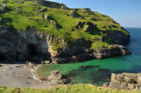
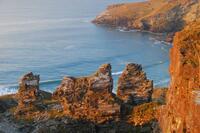
Below the the island upon which Tintagel Castle is perched, there is a small sheltered pebble beach, known locally as Castle Beach although on maps you'll see it marked as Tintagel Haven. Slate from the coastal quarries was brought here by donkey, and loaded onto beached ships which also brought in cargoes such as Welsh coal. Beside the waterfall is the remains of a derrick which was used to winch the cargo to and from the beach. In order to manoeuvre them around the dangerous rocks, ships were "hobbled" (towed by rowing boats then manoeuvred by gangs of men pulling on ropes).
On the left side of the beach is Merlin's Cave, and to the back of the beach is a waterfall where the stream running through the Vale of Avalon meets the sea.
- Tide times
- Beach info
- Map
- Dogs: allowed all year
Walks visiting Tintagel Haven beach
-
2.7 miles/4.4 km - Moderate
Tintagel to Bossiney
Tintagel to Bossiney
2.7 miles/4.4 km - Moderate
A circular walk via through Tintagel to Tintagel Castle and along the coastline via the headlands of Barras Nose and Willapark to the sandy beach at Bossiney Haven from Tintagel Haven where Merlin's Cave is uncovered at low tide.
-
3.8 miles/6.1 km - Moderate
Tintagel to Rocky Valley
Tintagel to Rocky Valley
3.8 miles/6.1 km - Moderate
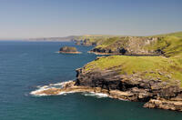
A circular walk via King Arthur's Great Halls and the Old Post Office and along the coastline from Tintagel Castle past towering headlands and island bird colonies to the golden, sandy cove at Bossiney Haven, returning via the labyrinthine carvings and ruins of mills in the woods of Rocky Valley.
-
5 miles/8 km - Moderate
Trebarwith Strand to Tintagel Castle
Trebarwith Strand to Tintagel Castle
5 miles/8 km - Moderate
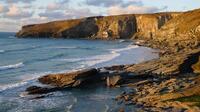
A walk on the tracks trodden by the donkeys laden with slate from the coastal quarries of Trebarwith to Tintagel Haven where the slate was loaded onto ships and Tintagel Castle's island, inhabited during the mediaeval period, the Celtic times of King Arthur, and before this by the Romans.
-
5.5 miles/8.7 km - Moderate
Boscastle to Tintagel (via bus)
Boscastle to Tintagel (via bus)
5.5 miles/8.7 km - Moderate
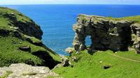
A one-way coastal walk, made circular via an initial bus journey, along the dramatic coastline of islands and arches from Boscastle to Tintagel, rated as one of the top five walks in Cornwall.
-
9.7 miles/15.6 km - Strenuous
Port Isaac to Tintagel
Port Isaac to Tintagel
9.7 miles/15.6 km - Strenuous
A one-way walk from Port Isaac to Tintagel along towering cliffs, past the long, sandy beaches of Tregardock and Trebarwith, the slate pinnacles of the coastal quarries and via the mediaeval cliff-top church to the castle of Arthurian legend.
Download the iWalk Cornwall app and use the QR scanner within the app to find out more about any of the walks above.

