Trebarwith Strand

The beach at Trebarwith is highly dependent on the tide - there is no beach at all at high tide and very little until mid-tide. At low tide, several smaller beaches merge into a mile-long sandy beach. There are rockpools to the right between Trebarwith Strand and Lill Cove.. Trebarwith is not the safest of beaches for swimming - it often has strong currents, rips and deceptively powerful waves - so advice from lifeguards should be cafefully followed.
- Tide times
- Beach info
- Map
- Dogs: allowed all year
Walks visiting Trebarwith Strand
-
3 miles/4.8 km - Easy-moderate
Tintagel Church to Trebarwith Strand
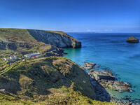
Tintagel Church to Trebarwith Strand
3 miles/4.8 km - Easy-moderate
A circular walk on quarrymens' trails along the cliffs of Tintagel past the Thunderhole blowhole to the long, sandy beach at Trebarwith Strand from Tintagel's mediaeval clifftop church with relics including the font that once stood in Tintagel Castle's chapel.
-
4.1 miles/6.5km - Moderate
Trewarmett to Trebarwith Strand
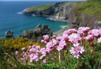
Trewarmett to Trebarwith Strand
4.1 miles/6.5km - Moderate
A circular walk down Trebarwith Valley to Trebarwith Strand then along the cliffs above the beach, with magnificent views of the bay between Dennis Point and Penhallic Point and the pinnacles of the coastal slate quarries now colonised by birds and wildflowers.
-
5 miles/8 km - Moderate
Trebarwith Strand to Tintagel Castle
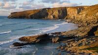
Trebarwith Strand to Tintagel Castle
5 miles/8 km - Moderate
A walk on the tracks trodden by the donkeys laden with slate from the coastal quarries of Trebarwith to Tintagel Haven where the slate was loaded onto ships and Tintagel Castle's island, inhabited during the mediaeval period, the Celtic times of King Arthur, and before this by the Romans.
-
2.2 miles/3.5 km - Moderate-strenuous
Trebarwith Strand to Backways Cove
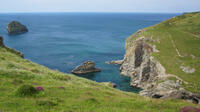
Trebarwith Strand to Backways Cove
2.2 miles/3.5 km - Moderate-strenuous
A short circular walk from the long, sandy beach of Trebarwith Strand to the rugged rocky cove at Backways in which sea foam tornadoes form in windy weather, and returning over the massive headland of Dennis Point with panoramic views of Port Isaac Bay.
-
4 miles/6.4 km - Moderate-strenuous
Trebarwith Valley to Backways Cove
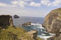
Trebarwith Valley to Backways Cove
4 miles/6.4 km - Moderate-strenuous
A circular walk in Trebarwith Valley to beaches and the coastal slate quarries of Backways Cove and Trebarwith Strand, and Dennis Point, overlooking the bay and point opposite where the ships moored to be loaded with roofing slates which were also brought down the valley on a road covered with beach sand to stop the horses being flattened by runaway carts.
-
9.7 miles/15.6 km - Strenuous
Port Isaac to Tintagel
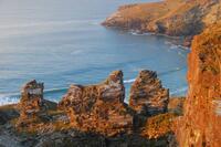
Port Isaac to Tintagel
9.7 miles/15.6 km - Strenuous
A one-way walk from Port Isaac to Tintagel along towering cliffs, past the long, sandy beaches of Tregardock and Trebarwith, the slate pinnacles of the coastal quarries and via the mediaeval cliff-top church to the castle of Arthurian legend.
Download the iWalk Cornwall app and use the QR scanner within the app to find out more about any of the walks above.
From Trebarwith Strand you can do a circular walk to Tintagel which goes along the coast past the castle. A circular walk in the other direction goes to Backways Cove with spectacular views over Trebarwith Strand from the top of Denis Point.
Options for visiting Trebarwith Strand as part of a walk include Tintagel church to Trebarwith Strand, Trewarmett to Trebarwith Strand or Trewarmett to Backways Cove, or the walk along the coastline from Port Isaac to Tintagel.

