Trevaunance Cove

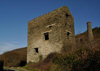
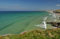
Trevaunance Cove is a shingle beach at high tide and is popular with surfers as its north-facing position means that the prevailing southwesterly winds are offshore. As the tide goes out, the central area of the beach is sandy. To the right, large areas of rock are revealed with numerous rock pools, and at low tide it is possible to clamber over the rocks to reach Trevellas Cove. On the left side of Trevaunance Cove are the remains of the old harbour wall and beyond this there are caves, arches and rock stacks along the cliffs.
- Tide times
- Beach info
- Map
- Dogs: allowed all year
Walks visiting Trevaunance Cove
-
3.1 miles/4.9 km - Moderate
Trevaunance Cove and Blue Hills mine

Trevaunance Cove and Blue Hills mine
3.1 miles/4.9 km - Moderate
A circular walk along the stream of Trevellas Coombe where tin ore is still worked using traditional water power, past Stippy Stappy - the row of sea captain's cottages, and down the valley to the sandy beach of Trevaunance Cove with the remains of Victorian harbour which was demolished by Atlantic storms.
-
4.7 miles/7.5 km - Moderate
Perranporth to St Agnes (via bus)

Perranporth to St Agnes (via bus)
4.7 miles/7.5 km - Moderate
A one-way coastal walk, made circular via an initial bus journey, along the ore-bearing cliffs between Perranporth and St Agnes passing the remains of Nobel's dynamite works, Britain's best preserved spitfire base and the Blue Hills of Trevellas Coombe where tin is still processed on a small scale using traditional methods.
-
6.2 miles/10 km - Moderate
Chapel Porth to Trevaunance Cove

Chapel Porth to Trevaunance Cove
6.2 miles/10 km - Moderate
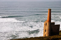
A circular walk along the coast between the golden sandy beaches of Chapel Porth and Trevaunance Cove at St Agnes via the iconic engine houses of Wheal Coates, perched above the breakers.
Download the iWalk Cornwall app and use the QR scanner within the app to find out more about any of the walks above.


