Walks in Cornwall with a good chance of seeing seals
Enjoy the walks by being guided by the app
-
2.2 miles/3.6 km - Easy-moderate
West Pentire and Polly Joke
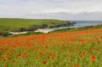
West Pentire and Polly Joke
2.2 miles/3.6 km - Easy-moderate
A circular walk through the poppy fields of West Pentire to Polly Joke beach, returning over the headland to the pub that was a cowshed until the mid-20th Century.
-
3.3 miles/5.4 km - Easy-moderate
Towan Beach to Place House
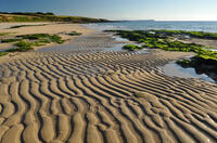
Towan Beach to Place House
3.3 miles/5.4 km - Easy-moderate
A walk on contrasting coastlines, from the rugged Roseland coast to the sheltered creeks of the Percuil River opposite St Mawes.
-
3.4 miles/5.4 km - Easy-moderate
St Anthony Head (short version)
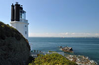
St Anthony Head (short version)
3.4 miles/5.4 km - Easy-moderate
A walk on the Roseland coast and then into the Fal estuary to St Anthony Church via the fort St Anthony Head and the golden sandy beaches of Molunan.
-
3.9 miles/6.2 km - Easy-moderate
Holywell to Polly Joke
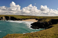
Holywell to Polly Joke
3.9 miles/6.2 km - Easy-moderate
A circular walk from Holywell Bay on the dunes and Kelsey Head to the sandy beach of Polly Joke.
-
4.9 miles/7.9 km - Easy-moderate
Holywell to Crantock
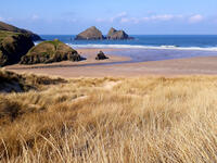
Holywell to Crantock
4.9 miles/7.9 km - Easy-moderate
A circular walk from Holywell Bay past the remarkable sacred spring and along the coast to the sandy beaches of Porth Joke and Crantock, returning via the dunes of the Cubert Common nature conservation area.
-
5.9 miles/9.5 km - Easy-moderate
St Anthony Head
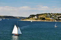
St Anthony Head
5.9 miles/9.5 km - Easy-moderate
A walk along the Roseland coast and creeks opposite St Mawes, passing the preserved fort and Fraggle Rock lighthouse on St Anthony Head and the golden sandy beaches of Molunan.
-
3.5 miles/5.7 km - Moderate
West Pentire to Crantock Beach
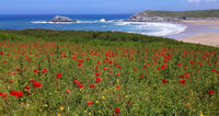
West Pentire to Crantock Beach
3.5 miles/5.7 km - Moderate
A circular walk on the northernmost end of one of Cornwall's largest areas of sand dunes that stretch from Crantock to Perranporth, under which one mediaeval chapel was found and another is said to still be lost.
-
4.3 miles/7 km - Moderate
St Ives
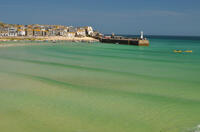
St Ives
4.3 miles/7 km - Moderate
A circular walk at St Ives along the granite coastline and white sandy beaches which have inspired so many artists, through some of the most famous parts of the town including the harbour, The Island and The Tate, and via the church and holy well of the Celtic girl Ia who, according to legend, was the first to settle here.
-
5.0 miles/8.1 km - Moderate
Hell's Mouth to Godrevy
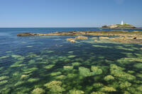
Hell's Mouth to Godrevy
5.0 miles/8.1 km - Moderate
A circular walk following the coast from Hell's Mouth past Godrevy lighthouse to the sandy beaches of St Ives Bay, returning via a pilgrimage route along the Red River Valley.
-
5.8 miles/9.3 km - Moderate
Newquay
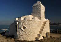
Newquay
5.8 miles/9.3 km - Moderate
A circular walk around the UK's surf capital which was transformed from a tiny fishing village with a few thatched cottages when, in order to export ore from the harbour, a horse-drawn tramway was built across Cornwall which later became part of the Great Western Railway.
-
6 miles/9.7 km - Moderate
Sennen Cove, Land's End and Nanjizal
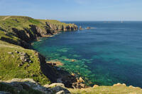
Sennen Cove, Land's End and Nanjizal
6 miles/9.7 km - Moderate
A circular walk from the white sandy beach at Sennen Cove along the towering granite cliffs via Land's End to the song of the sea cave at Nanjizal. The best way to see Land's End.
-
6.8 miles/11 km - Moderate
St Ives to Carn Naun
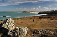
St Ives to Carn Naun
6.8 miles/11 km - Moderate
A circular walk from St Ives on the ancient churchway towards Zennor and returning along the rugged coast to Porthmeor, where a Victorian cargo ship and the St Ives lifeboat were both wrecked and the ship's boilers are still visible at low tide.
-
6.9 miles/11.2 km - Moderate
Holywell Bay to Newquay (via bus)
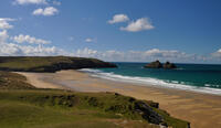
Holywell Bay to Newquay (via bus)
6.9 miles/11.2 km - Moderate
A one-way coastal walk, made circular via an initial bus journey, from Holywell Bay along the coast and Gannel estuary to Newquay, passing the beaches of Porth Joke and Crantock and the headland of West Pentire where there is a spectacular display of red-and-gold wildflowers in June.
-
4.9 miles/7.8 km - Moderate-strenuous
The Strangles to Buckator
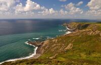
The Strangles to Buckator
4.9 miles/7.8 km - Moderate-strenuous
A circular walk along the volcanic coastline north of Boscastle, including Cornwall's highest cliff and The Strangles beach with its spectacular arch known as the Northern Door.
-
5.4 miles/8.7 km - Moderate-strenuous
Boscastle to Buckator
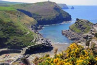
Boscastle to Buckator
5.4 miles/8.7 km - Moderate-strenuous
A circular walk along the coastline from Boscastle via the Pentargon waterfall and the rugged cliffs at Buckator, returning along the Valency valley.
-
5.4 miles/8.6 km - Moderate-strenuous
Zennor to The Carracks
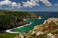
Zennor to The Carracks
5.4 miles/8.6 km - Moderate-strenuous
A circular walk towards St Ives from Zennor following the Coast Path past the haunts of the legendary mermaid of Zennor to the islets of The Carracks, frequented by seals, and returning on the Coffin Path, along which villagers made their final journey to Zennor church.
-
7.7 miles/12.4 km - Moderate-strenuous
Zennor to St Ives (via bus)
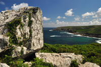
Zennor to St Ives (via bus)
7.7 miles/12.4 km - Moderate-strenuous
A fairly demanding but rewarding one-way coastal walk, made circular via an initial bus journey, along the rugged coast between St Ives and Zennor, passing Seal Island which may have given rise to the legend of the mermaid of Zennor and - thanks to some imaginative naming - ice cream (Moomaid of Zennor). The walk is in the optimal direction to remove time pressure and for panoramic views across St Ives bay.
-
12.1 miles/19.4 km - Moderate-strenuous
St Ives to Zennor
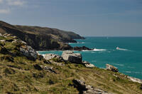
St Ives to Zennor
12.1 miles/19.4 km - Moderate-strenuous
A fairly long and demanding but rewarding circular walk along the coffin path and rugged coast between St Ives and Zennor. The walk is organised so that the coastal section is in the optimal direction for panoramic views across St Ives bay.
-
7 miles/11.2 km - Strenuous
Crackington Haven to Boscastle (via bus)
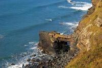
Crackington Haven to Boscastle (via bus)
7 miles/11.2 km - Strenuous
A one-way coastal walk, made circular via an initial bus journey, along the Shipwreck Coast from Crackington Haven to Boscastle passing the highest cliff in Cornwall and the long, sandy beach at The Strangles.
Download the iWalk Cornwall app and use the QR scanner within the app to find out more about any of the walks above.
